##
## NOTE: this file is not accessed directly, but is read by
## http://www.atmos.washington.edu/~ovens/loops/viewer.cgi
## as called by the Weather Discussion Page: /data/wxdisc.cgi
## and is added to the dynamic Web page that the viewer.cgi script
## generates. Use standard HTML, but you may also add comments if the
## line starts with '#'.
##
## Start each new link line with " " to keep it looking nice.
##
## Questions should be referred to David Ovens (ovens@atmos, 5-8108).
##
##
## Leave this link alone.
 Back to Weather
Discussion Main Page
##
## EDIT BELOW HERE, REMOVE COMMENT CHARACTERS '##' BEFORE
TO DISPLAY.

Since last week...
500 hPa Heights
250 hPa Heights/Wind Speed
April 8 Severe Event (East Coast)
SPC Summary
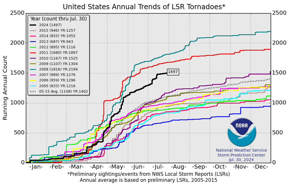
Annual Tornado Statistics
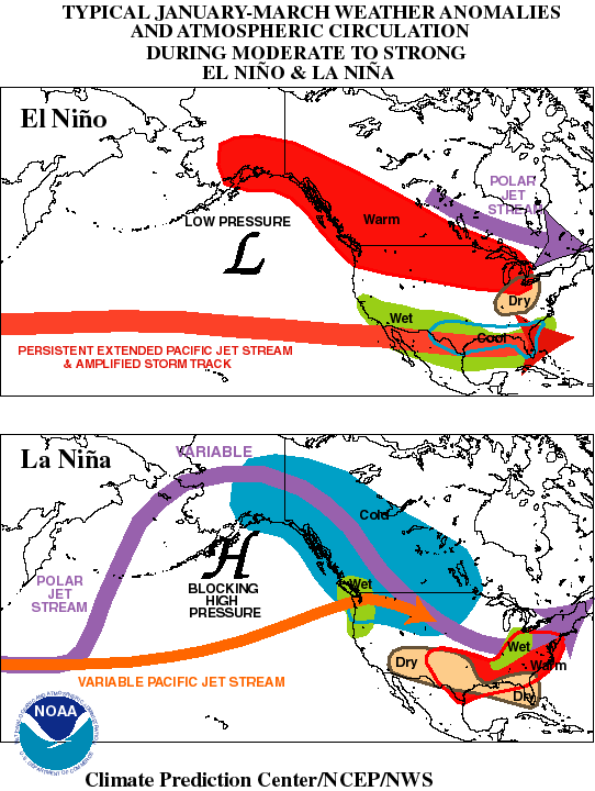
ENSO circulation anomaly schematic
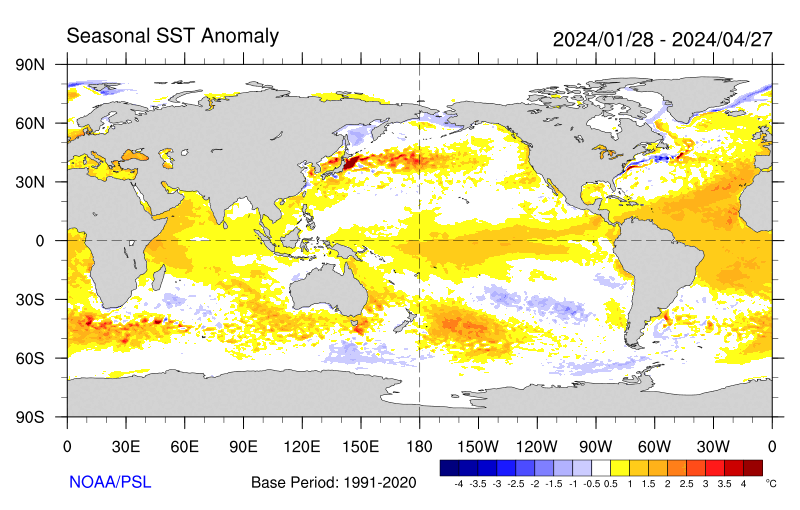
JFM SST Anomalies
Current Conditions
W. WA Surface Map
IR Satellite + 500 hPa heights (3 day loop)
SLP + 500 hPa heights (3 day loop)
Monday's Max Temps
Rooftop Meteogram - 72-hr summary
Tour of local webcams - Queen Anne - Sandpoint - Silverdale
Satellite - U.S. - W. WA
A brief historical diversion...TIROS-1..."Loop"...Hardware
Surface - Winds/SLP
Upper Air - 500 hPa - 250 hPa
Spring has sprung:
Flooding, Drought, Fires, Dust Storms, and the Harmattan
- Part One: Flooding -
February NWS Press Release
Antecedent Snow Cover / Snow Depth conditions
Fargo, ND / False & Natural Color
Current Hydrograph
- Part Two: Drought -
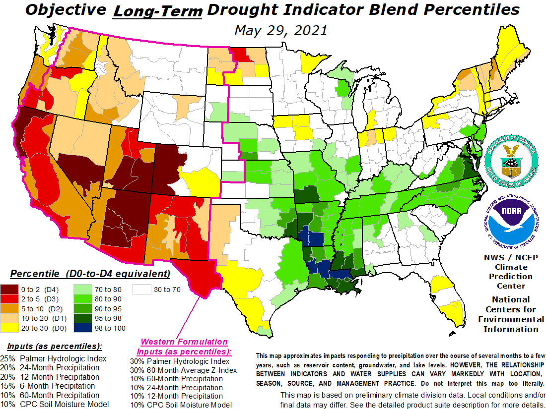
US Drought Monitor - Long Term Drought Indicator
China Drought Monitor
- Part Three: Dust Storms -
Taklimakan
Spring in China
Mongolian Cyclone
Long range transport
- Part Four: The Harmattan -
Unusually Late
Dust and haze
Global Aerosols, March 2010
Forecast for the rest of the week
WRF-GFS 36km 500 hPa Z (0 - 72 hrs.)
MM5-NAM 12km pcp3 (0 - 72 hrs.)
WRF-GFS 4km pcp3 (0 - 48 hrs.)
GFS 500 hPa heights + SLP (0 - 96 hrs.)
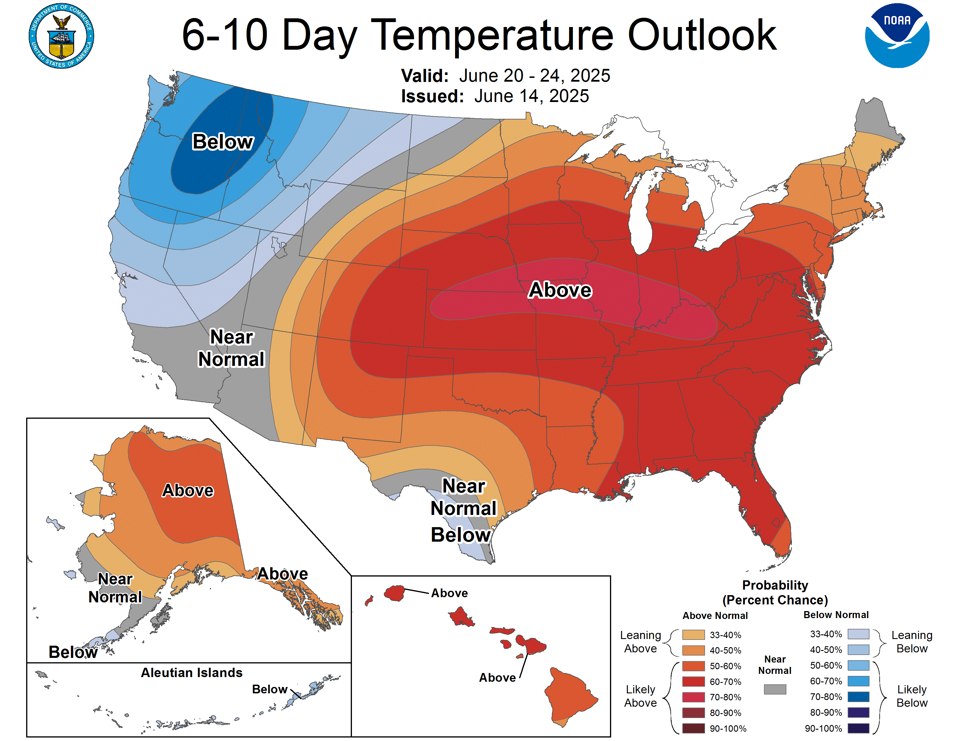
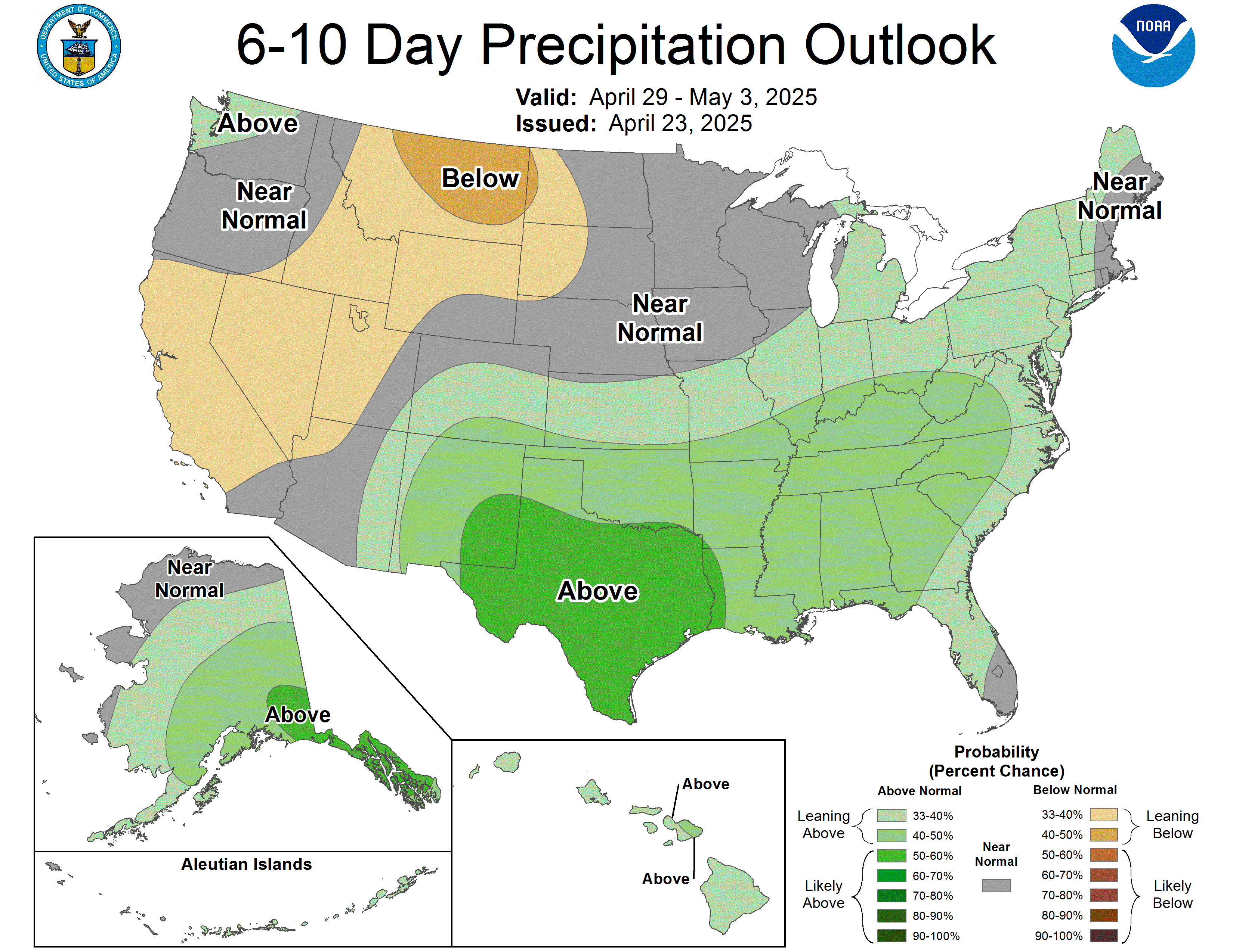
U.S. 6-10 Day Outlook
ESRL PSD Ensembles - Z500'
CPC Outlook - Temperature - Precipitation
##
## A SAMPLE LINK:
## NCEP Short Range Ensemble Page
## A SAMPLE LOOP. For each loop, create a subdirectory of
## /home/disk/stormy/atmos/data/wxdisc/YYYYMMDD (where YYYYMMDD is the
## date of your discussion) for all images to be looped.
## Long Range Forecasts of Snow Storm
##
## The viewer.cgi program automatically displays any
## image files in this directory below this portion of the
## html page.
IMAGES: